Day 30: Hexworthy to Tavistock 14.5 miles
- Sep 21, 2025
- 4 min read
Updated: Sep 22, 2025

The Dartmoor B&B and the Forest Inn provide us with good pub food and a comfortable stay. Hexworthy is almost in the centre of Dartmoor and there is no other accommodation or substantial refreshments for miles around, so they do a good trade. It was a very welcome stay and we leave a lot drier and less bedraggled than we were when we arrived.

It’s bright and sunny outside but the temperature has dropped considerably and we both don our down jackets soon after setting off. We are still following the High Moor Link path that we picked up from Dartmeet yesterday. We will follow it for most of the day. This 23 mile route links Buckfastleigh to Tavistock across the middle of Dartmoor, enabling the Dartmoor Way to be followed as two smaller halves. We could not use this on our first day as we needed to head south. The northern, more remote section of the moor is intermittently out of bounds as much of it is a Ministry of Defence training ground, sometimes using live ammunition.
As we head up onto the moor, we spy a kestrel overhead and meadow pipits pop up sporadically from the undergrowth. The loveliest creatures though are the tough Dartmoor ponies, some in family groups, others on their own or in small herds. Seeing a foal with a mare and a stallion reinforces how unnatural our animal husbandry has become. The Dartmoor ponies are only semi-feral though. All of them belong to Dartmoor commoners. The ponies have been domesticated here since 1500 BC, and graves in southern England have contained wild horse bones as far back as 3500 BC.

The day is cool, bright and crisp, the views are panoramic and the path springy underfoot (if a bit squelchy in places after yesterday’s biblical deluge). We gently descend to the river Swincombe. I’m relieved to find that there’s a footbridge as there is nothing marked on some maps and the old stepping stones are again mostly submerged.

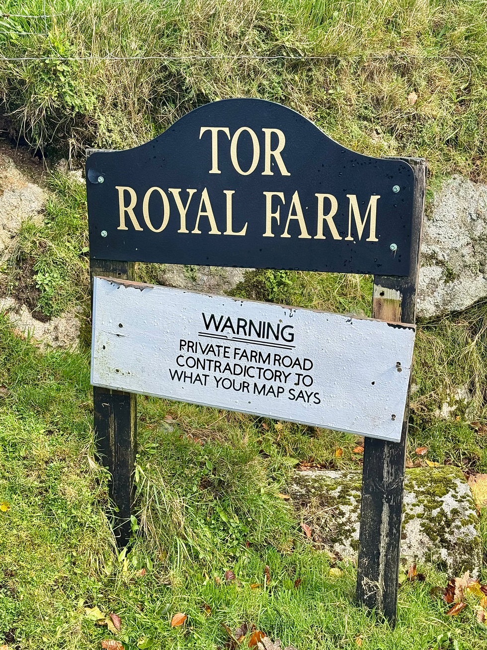
The route continues steadily uphill across the moorland. There are various named stones and prehistoric sites, but they’re unidentifiable from the path. Eventually, we descend to Tor Royal Farm. Rich suggests we leave the route and follow the unadopted road up the slope. It’s only when we get to a road that we spot a sign stating that this is not a right of way.
We keep climbing and I wonder if, at 453 metres, we are at the highest point of our walk. Rich consults the map, but it transpires that our high point was yesterday at around 474 metres when Rich took a photograph of me struggling with the elements. We hadn’t even noticed.

We next drop down to the town of Princetown, famous as the location for Dartmoor Prison, where Eamon de Valera was once incarcerated for his role in the 1916 Easter rising (before he was Irish president). The prison has been closed since 2024 when radon gas concentrations 14x the permissible limit were recorded. In 2023, the Ministry of Justice signed a £37 million, 25 year lease for the prison from the Duchy of Cornwall.

Princetown has two cafes, a convenience shop, the National Park Visitor Centre and, of course, the Dartmoor Prison Museum. We have flat whites and apple cake at the Fox Tor cafe then buy lunch from the shop. We then set off along a disused railway track, as usual solid underfoot with a gentle gradient and easy to follow.

We are definitely leaving the granite plateau now and both of us vow to return again: the austere, haunting landscape deserves more exploration. Dartmoor is a granite extrusion formed around 280 million years ago. It comprises the Cornubian batholith together with Bodmin Moor, St Austell, Carnmenellis, the Isles of Scilly and Land’s End. It’s tors were not formed by glaciation, as the glaciers were further north, but are the result of weathering either chemical or mechanical from the freeze-thaw of the ice ages.
We carry on deep into the valley of the appropriately named river Walkham, looking for a lunch spot. There is a bench in the woods, but the gate to it is locked. We continue up the hill into the tiny hamlet of Sampford Spiney, which has an impressive church. As we pass through the kissing gate, we hear organ music. Richard is worried as it’s Sunday, but there are no services in the middle of the afternoon, so the organist is practising. We head for a granite bench which is not cold, as I expected, but warmed by the sun and surprisingly comfortable. It’s an incredible lunch spot, high on the very edge of the moor, serenaded by organ music.

We leave across common land and rejoin the High Moor Link. Rich locates some more common land links and, while the terrain is sometimes ‘bobbly’, it’s good not to be on yet more tarmac. The ladder stiles and random ‘footbridge’ are another matter, as is the random sign declaring Tavistock to be 199 miles.

We soon find ourselves crossing a golf course incongruously frequented by Dartmoor ponies and heading into the attractive town of Tavistock and our rest stop at the luxurious Apple Pie apartment.
Total distance: 423 miles


Comments