Day 30: St John’s Chapel to Alston 19 miles
- Aug 8, 2022
- 3 min read

We leave a bit later today because breakfast was not available until 8.30am. It was a great breakfast though and we’re going to need it as it’s a long day today and the end of seven days straight walking.
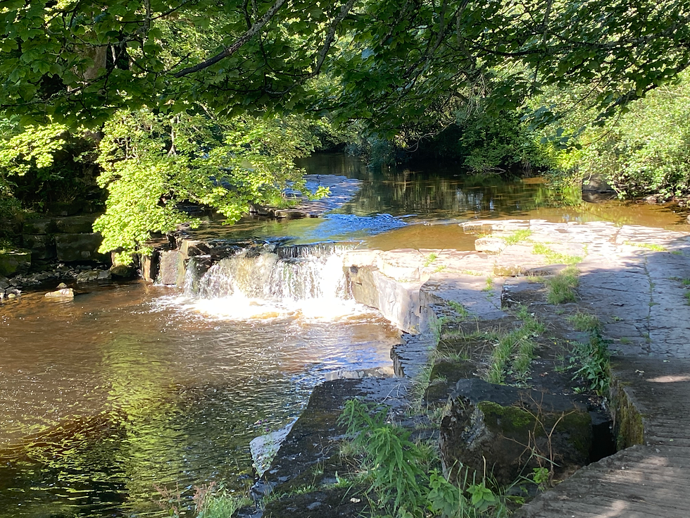
We head off down to the river Wear to pick up the Weardale Way. This begins as a lovely path along the upper reaches of the river Wear, with rapids and small falls along the way. Almost immediately, we disturb a pair of grey herons. There must be plenty of fish in the river here, as these are the first of several herons we see today.
We reach Wearhead where Killhope Burn and Burnhope Burn join to form the Wear. The Weardale Way follows Killhope Burn, whose name belies its benign nature in the sunshine. A flooded quarry and more herons, then the Way moves away from the burn and up onto the hillside. We follow tracks across the fell, then reach an apex where the waymarked path turns down the hill. We elect to cross the moorland towards the road, avoiding mineshafts and deep streams along the way. Soon, we ford a stream that is one of the headwaters of the Wear, climb a fence and reach the A689. We decide to take the road to the brow of the hill: Killhope Cross.
Killhope Cross is the joint highest paved pass in England at 627 metres (2057 feet) and is where County Durham joins Cumbria (nearby Harthope Moss is the other joint highest pass). Killhope Cross is also our highest point so far by a few metres. A few hundred yards to our right is the triple point on the fell top where Cumbria, County Durham and Northumberland converge. We stop for a selfie, as do some of the cyclists on the London to Edinburgh race. Cumbria, however, will soon be Cumbria no more.
In 1974, Cumbria was formed from Cumberland, Westmorland and part of Lancashire. It has always been an uneasy marriage. The plan is now to separate it into Barrow-in-Furness and Westmorland, and Cumberland, bringing back the old county names. We go down into Cumbria for a few metres, climb a grassy knoll on the side of the road and stop for lunch and, as the grass is amazingly soft, a brief nap.
After lunch, we follow the road for a little way down the hill into Nenthead, one of the highest villages in England. We are now in South Tynedale and we take Isaac’s Tea Trail, which initially follows the river Nent. The route is named after Isaac Holdon.
Isaac was born poor and, with minimal education, became a lead miner. In the early to mid 19th century, lead mining began to fail and Isaac became a tea seller, one step away from entering the workhouse. Isaac was lucky: the cost of tea duties fell and his custom flourished. He became a familiar figure in his black garb, walking around the dales peddling tea. He also became pious and was celebrated by the local clergy. Isaac’s Tea Trail is based on a putative route that Isaac might have taken.
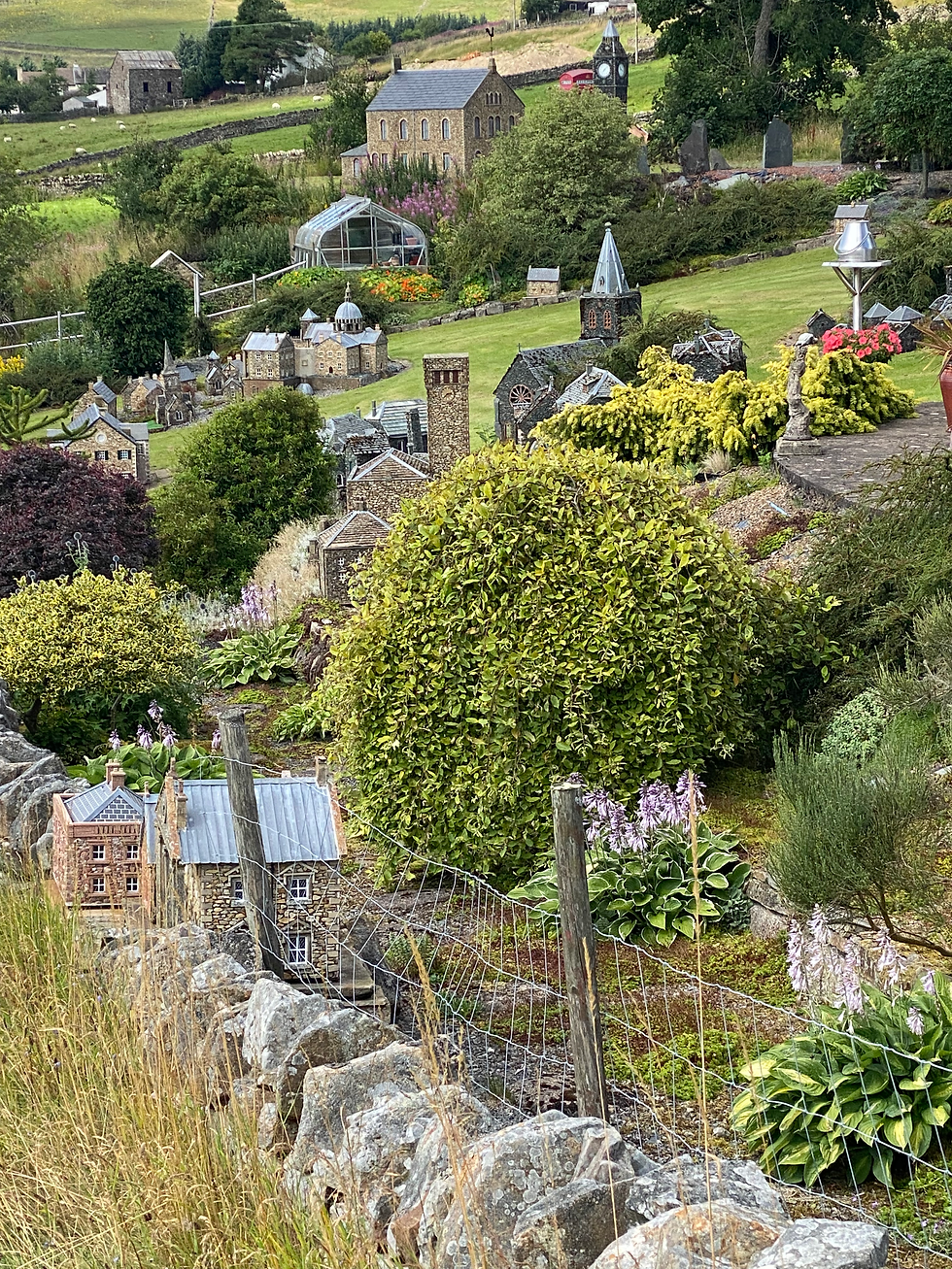
We soon come across a model village in a garden. The buildings are the work of a erstwhile engineer who wanted a hobby in retirement. He now sells his wares, as well as displaying some in his garden to raise money for the air ambulance. He explains to us his manufacturing technique, involving plywood moulds, concrete and stone pieces set into thick aluminium sheets discarded by the council that he uses as bases. It sounds as if his constructions would withstand a nuclear blast! He asks us where we are from and what is the stone there. He is keen for us to provide him with some small Norfolk flint pieces if we get the chance.
We continue along the Tea Trail, now heading away from the river and up the hillside, as seems to be invariably the case. The Weardale man we met yesterday described this area as ‘Deliverance’ country. As we pass the dilapidated, fellside houses, I can definitely hear a banjo playing in my head. We descend, eating wild raspberries along the way and then the trail takes a detour up a valley and we take the road again for a while.
After about a mile and a half, we pick up the trail again, now running on the south bank of the river Nent. We follow this, unsettling the sheep and some curlews, into Alston and reach Lowbyer Manor, our stop for the night and our next two rest days. We have completed seven hard, hilly days and the rest is very welcome.

Total distance so far: 365 miles


Comments