Day 4: Downham Market to March 16 miles
- 2 days ago
- 5 min read

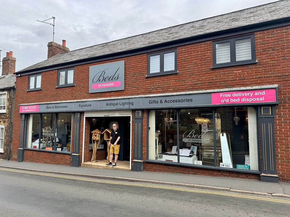
Another stupendous breakfast at the Crown Hotel, this time with fried bread, the king of the full English, and veggie bacon and spicy sausage. We leave via the back entrance onto Paradise Road. Every business here seems to have paradise in its name including ‘Paradise Beds,’ which confusingly seems to be selling bird tables, and it’s sister shop around the corner ‘Living in Paradise’. We buy lunch from Greggs and head out of town past the railway station.

We pass the huge Heygate’s flour mill. Originally built in 1851 and steam driven, it now mills more than 90,000 tons of wheat per year. We cross the Great Ouse Relief Channel on Hythe Bridge, where I spot a couple of sand martins, and briefly join the Fen Rivers Way and Ouse Valley Way. The Ouse Valley Way is a 150 mile route from the source of the River Great Ouse in Syresham, Northamptonshire, to the Wash. The Fen Rivers Way is a 50 mile trail from Cambridge to King’s Lynn. It starts following the River Cam which then joins the Great Ouse just before Ely and the two paths coincide. We follow this for a shortish distance then cross the river itself on Downham Bridge and pick up a path on the other side.

This path is a section of the Black Fen Waterways Trail. This is a 62 mile circular route through Ely, Littleport, Downham Market, Nordelph, Outwell, March, Chatteris, Sutton, Wilburton, Stretham Old Engine and Little Thetford. Some of these places I’ve never heard of, let alone visited, but they sound intriguing. We are now in Fenland proper and the immaculately kept path on the high bank provides spectacular views for miles across the landscape.

At first sight, this scenery appears flat but it is in fact peppered with small undulations. These arise where the peaty soil expands and contracts in wet and dry weather. It also does this beneath the road surfaces creating unpredictable dips and adverse cambers that make driving on the fens feel like you’re on a fairground ride rather than a car journey. Looking closely at the cracks in the road today, there seem to be cavities underneath them.


We are now approaching Denver Sluice, something I’ve always been curious to see. I’m not sure if this is because my office at King’s Lynn sits on the corridor to Denver Ward or just because I like the sound of the name. We don’t visit the sluice on this occasion, but I do get to see it from a distance. Something to save for another day.

We reach Salter’s Lode Lock and are now at the confluence of four different channels: the River Great Ouse, the Old Bedford River, the New Bedford River (or Hundred Foot Drain) and Popham’s Eau. There are few bridges across these drains and rivers and, unlike some highland rivers, these deep channels are not fordable, so we make sure that we end up on the south bank of Popham’s Eau as this leads to the village of Nordelph. Popham’s Eau is a drain cut by Lord Chief Justice Sir John Popham between 1605 and 1609 to connect the River Nene with Well Creek in an attempt to drain the area. The attempt failed but the drain remains and is very attractive as it goes into Nordelph village with buddleia bushes alive with red admiral and peacock butterflies.

We walk through the village and join the B1094. This road is in part along the line of the Fen Causeway, a Roman Road built during the reign of Emperor Nero to connect Peterborough and Denver with all the industrial sites in between. The Romans took over the salt production in the fens from the Iron Age people who lived there. The hundreds of brackish rivers and creeks of the salt marsh proving ideal for this purpose. Needless to say, the Fen Causeway had to be rebuilt several times because of peat movement and periodic flood silts. At an unmarked point along the B1094, we finally leave Norfolk and enter Cambridgeshire.
When we reach the despondently named World’s End, we have a choice of whether we I stay on the road or take a slightly longer footpath and track route. We have not enjoyed the cars bouncing past us through the potholes at 60 miles per hour, so we take the track up to World’s End Farm. When we get to the end of the track, there is a Public Footpath sign but no sign of a footpath. We make our way fairly easily through the wheat field though, until we reach a ditch. We gingerly locate the way across the, getting heavily stung in the process. We emerge onto a lovely, wide, grassy track, however, and, having passed some abandoned pushchair wheels in the middle of nowhere, stop for a break amid the cornflowers and dog daisies.

The grassy track soon becomes metalled and then we climb a gate to reach an unclassified road. The track is a public right of way, despite the gate with the ‘Private road no access without permission’ sign. Rich wonders if we should use guerilla tactics and get some public footpath stickers made to affix to gates like this one. We both agree that it’s probably illegal.
The road leads us to the A1101, at 53.5 miles the longest A road with four digits and the only route directly linking Suffolk and Lincolnshire. It is also the lowest road in Britain and one of the most dangerous. Fortunately, there is a pavement all the way to the hamlet of Three Holes and the B1098. We follow this briefly, then pick up an unclassified road towards Upwell. We meet a friendly Anglian Water man who tells us to watch out for kingfishers along the riverside.
Yet again we follow a public footpath sign that is speculative at best and the path by the River Nene at this point is so overgrown, that it’s all we can do to avoid falling in the river let alone look for kingfishers. We arrive at Marmont Priory Lock and stop for a shady lunch under the bridge.

We then follow another unclassified road on the north side of the River Nene (old course) until it becomes a wide, grassy track leading to Coldham wind farm. The wind farm is quite beautiful and we see Great Crested Grebes, but the vista is unchanging and it’s become very hot again. When we reach Twenty Foot River and turn north, we know we are getting closer to our destination. Twenty Foot River is in fact a very old drain designed by Sir Cornelius Vermuyden as part of his great drainage system of 1649-1653. It now forms part of the Middle Level Drainage system connecting the Great Ouse and the Nene. This entire system is now maintained by the Middle Level Commissioners, a locally funded public authority who own and operate the critical infrastructure here for the benefit of the fenland community.
Crossing the somewhat derelict bridge over Twenty Foot River, we pass a sewage plant and continue along a very subsided unclassified road. We pass a property with an interesting fence made of old tyres and dead Leylandii. It looks like a lot of work has gone into it but is a bit odd and not quite yet finished.

Eventually, we reach the outskirts of town and pick up another path by the river to lead us to the town centre and Ye Olde Griffin Hotel, our welcome stop for tonight.

Total distance: 56 miles


Comments