Day 59 Cluanie to Inverinate 20 miles
- Sep 6, 2022
- 3 min read
We are well rested and have a good breakfast at Cluanie Inn, accompanied by hooded crows hopping outside the window. We discuss our plans for the section after Ullapool, but despite a good discussion, reach no firm conclusions. We then buy some goodies from the Landour Bakery across the road, which has the same owners as the hotel. Next we walk along the A87 to the start of the route proper.
The way starts as a track in the valley but after a couple of miles becomes a faint, marshy path. Eventually, it's just a bog, though the way forward is obvious as it's straight through the glen. We each have a substantial brownie from the bakery and this time it's Richard's turn to sit on an ants' nest.
We now have a decision to make. The prescribed route takes a detour north east to the remote Alltbeithe youth hostel to attain a footbridge across the river Affric. This, and it's concomitant long, boggy trudge, can be avoided by climbing the ladder over the deer fence and wading the river. After honing our river crossing skills yesterday, there is no contest and we both manage to wade the river without getting our feet wet ( thank-you gaiters).
We now pick up the Affric-Kintail Way through Fiongleann and into the Kintail Forest (a forest of mountains, rather than one with trees). This is an excellent path with occasional bog, so a big improvement. It takes us past the Camban bothy, maintained by the Mountain Bothy Association. Rich and I decide to take a look inside, as neither of us has ever visited a bothy before and we are likely to be staying in at least one soon. It's much more palatial than a two-man tent! Before our trip, I joined the Mountain Bothy Association (very cheap) as I didn't think it was right for us to use bothies without contributing. Bothies, however, are open to anyone who needs shelter in the mountains at no cost and no-one is turned away. They can be lifesavers.
We chat to a pair of cyclists who used the bothy overnight and to a bus driver from Gouda in the Netherlands. He loves the mountains and was looking at jobs in Scotland, but sadly he thinks the cost of living here is too high. We also talk to him about camping gear as his pack looks really heavy. He tells us he's chosen comfort and reliability over lightweight gear. He goes on his way ahead of us and we follow the path into Gleann Lichd behind the five sisters of Kintail.
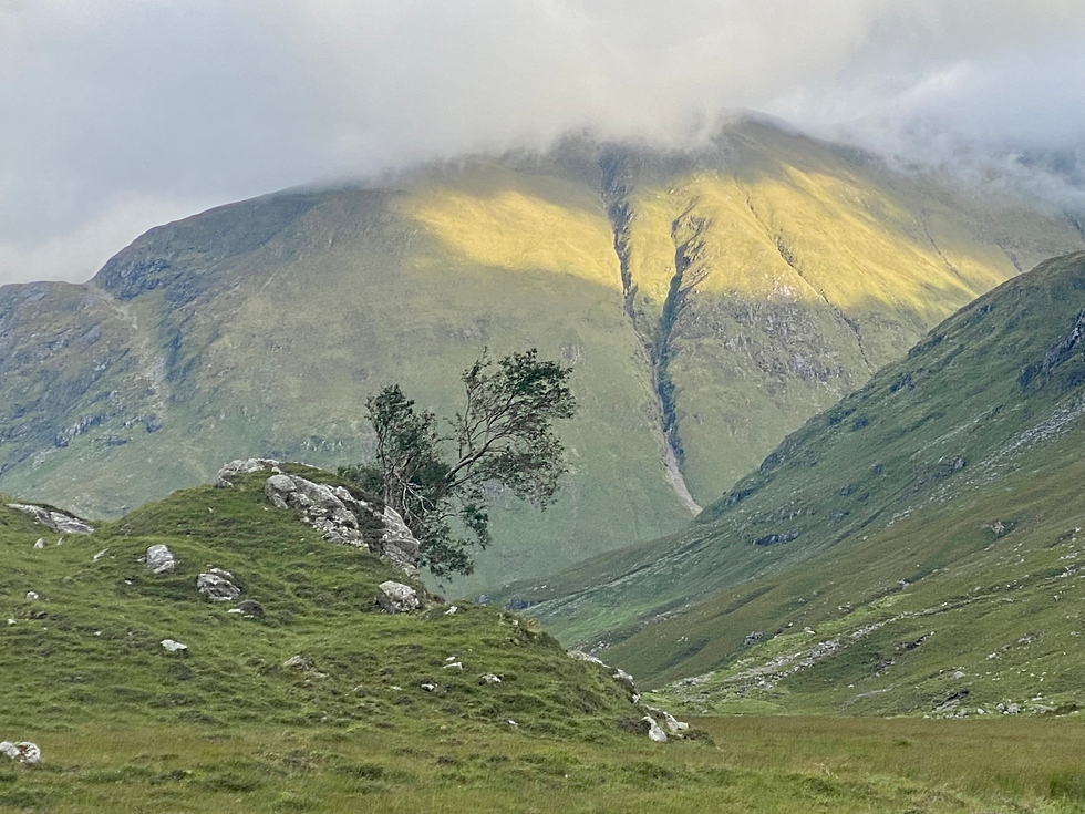
The path weaves its way around the drumlins and Rich and I discuss all the geographical features. These mountains were thrust up by fault activity and then moulded by glaciation and river erosion. All around us, there are fine examples of U-shaped valleys, hanging valleys, gorges, interlocking spurs and of course the mounds of glaciated moraine that make up the egg-like drumlins, with dungeons between them.

The path then descends, not just past, but across the waterfalls of the Allt Grannda. The falls are hundreds of metres high and the path goes right across the tallest (the green ledge visible in the final picture). It's an easy crossing technically but the location is spectacular with falls above and below us. The path then continues on to a footbridge across the river and a memorial mountain hut. The bus driver from Gouda is now setting camp by the river below us.
We pick up a track that makes easy going past sheep, cows and more hooded crows. It's the first time we've seen livestock for a while. Farmers in a small 4x4 with a trailer containing three border collies are trying to persuade a recalcitrant bull to rejoin the herd. He's definitely not keen.
The track continues into Morvich but we press on to reach the A87 and Loch Duich, a sea Loch containing seals, otters, dolphins and occasionally minke whales. We only see a mallard today. We reach Otterburn B&B just as the rain starts and are greeted by Mike and Peta with lasagne and tea. A fantastic welcome prior to our rest day here tomorrow.

Total distance so far: 744 miles


Comments