Interlude: The South Downs Way. Day 4: Findon to Cocking 20 miles
- Jul 17, 2025
- 4 min read

We have a lovely breakfast and leave Findon Manor in good time as we know we have a long day ahead. As we check out, the guy at the desk asks where we’re headed today. “Cocking” we say. “That’s a long way” he replies, sounding doubtful. We set off and buy provisions at the community store. Like the one in Firle, it has an eclectic mix of wares.
We head up to a roundabout to cross the A24. It is not easy. We then have to walk beside the A280 for a short way. It has no pavement and is busy in the rush hour, but the drivers are all unfailingly polite and considerate. Nevertheless, we are pleased to turn off onto a bridleway.
The bridleway cuts through a field of sweetcorn. I take the lead, unable to see over the plants and collecting the morning cobwebs along the way. The day is turning warm and very humid.
We follow a track up a gentle slope aiming to regain the South Downs Way. Despite being an unmade byway through the countryside, it seems to be frequented by all sorts of vehicles: saloon cars, a gritting lorry, a domestic oil tanker and, of course, tractors. We have no idea why they’re here or where they could be going. Maybe they were visiting the nearby Roman well.
We meet a walker with a heavy pack admiring a skylark, presumably heading to Findon for provisions. He looks very weary despite the early hour. He probably slept in a tent. We reach the trail, glad of a breeze in the humidity. We pass some more people on a groundsheet, presumably having broken camp, sorting out their feet in the open air. Looking ahead, we can see Glatting Beacon beckoning us on from the distance.

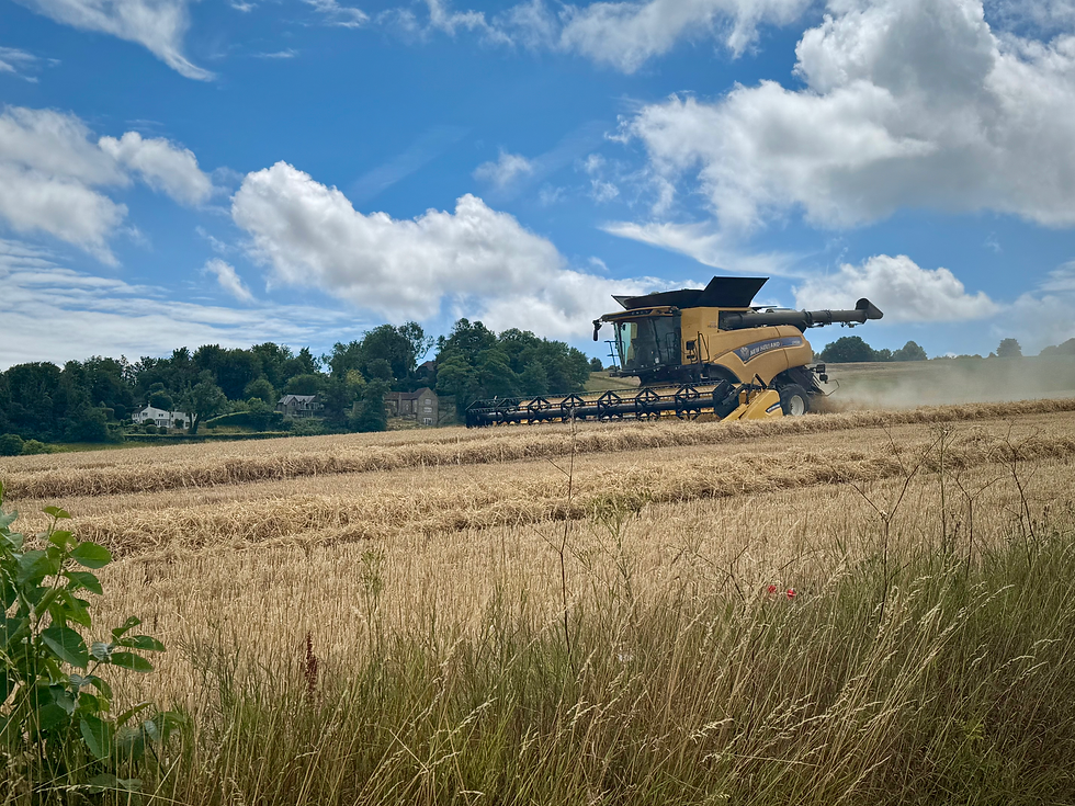
As the ridge continues, we enter a wooded area and look for somewhere to stop for a break. We settle on an inviting patch of long grass at the crossroads of some paths. We start our chocolate (Tony’s Chocolonely today), and can hear an engine, seemingly in the distance. Soon it is getting closer and we have to move out of the way of a small combine that is exiting the gate we sat down in front of. We regroup, finish our chocolate and lie back to rest. About fifteen minutes later, the farmer and his combine return. He apologises profusely for disturbing us again, but it’s time to be on our way in any case.
We follow the hill a bit further, but it soon begins to descend. We meet several cyclists on the way down, one of whom stops for a chat. He lives locally, despite his strong Northern Irish accent. “Where are you going today?” he asks. “Cocking”. “That’s a long way” he says.
We are now heading down to Amberley to cross the river Arun, at 37 miles, the longest river solely in Sussex. The river is tidal in Amberley, so we are back down to sea level. I am desperate for the loo (one of the hazards of eating so much to fuel the walk), so we pop into the Riverside Tea Rooms for tea and cake. We follow the river for a while, then head back upwards again, passing yet another, much bigger combine as we go.
The view is stupendous. We can see all the way back to Firle Beacon and, suddenly, the Isle of Wight appears. The island is another area of chalk downland, separated from the mainland during the last ice age.


We are now heading down Westburton Hill and then up Bignor Hill. Part way up is Toby’s Stone, a monument to Toby Wentworth-Fitzwilliam, the secretary of the Cowdray Hounds in the shape of a horse mounting block.

We summit the hill, then head down to where the South Downs Way crosses Stane Street, the old Roman road from Noviomagus Reginorum (Chichester) to London. Stane Street forms part of the Monarch’s Way. The road also leads down to the nearby Bignor Roman Villa, with its world class mosaics. Rich remembers me taking him there years ago. We go a bit further on, then stop for a late lunch As we finish, Rich tells me that Google maps says Cocking is 7.2 miles and three and a half hours away. It is already after four o’clock.

The sun is now shining strongly and the forecast 26 degrees has arrived to augment to the discomfort from the humidity. We decide to go on a brief diversion to Glatting Beacon, 245m and a primary trig point, so a must for Rich. Unusually for one so high, it is in a copse of trees. Rich leaves a five pence piece on the top. When I ask him why, he replies that someone else has left a washer there.

We now descend yet again, this time crossing the A285 at Littleton. We now commence the last major ascent of the day up to Graffham Down. Here the path is in trees (a godsend in the heat and sunshine) and is relatively flat for some time. We also divert a little to follow parallel paths on the Graffham Downs Trust’s nature reserves, as these are across grass rather than the more punishing bare chalk. Here we spot a large roe deer in the trees. We have seen two lizards, two red kites and a buzzard today, so the biodiversity definitely seems to be improving.
This section of the walk also coincides with the West Sussex Literary Trail, a 55 mile long meandering route from Horsham to Chichester. The literary connections are somewhat tenuous but sites along the trail are linked to Shelley, Blake and Keats. It goes past the Roman Villa and the Weald and Downland open air museum, so it takes in some of my favourite local places at any rate.
After a long and enjoyable sheltered ridge walk, we emerge into the sunlight and turn off right across a field to descend into Cocking. The steep downhill is across a sheep field at first but soon enters a wood where several fallen trees block the path. We skirt round them, cross the A286 and arrive at the Blue Bell Inn in Cocking, our overnight stop.

Total distance: 70.5 miles


Comments